Edges of (All) Life

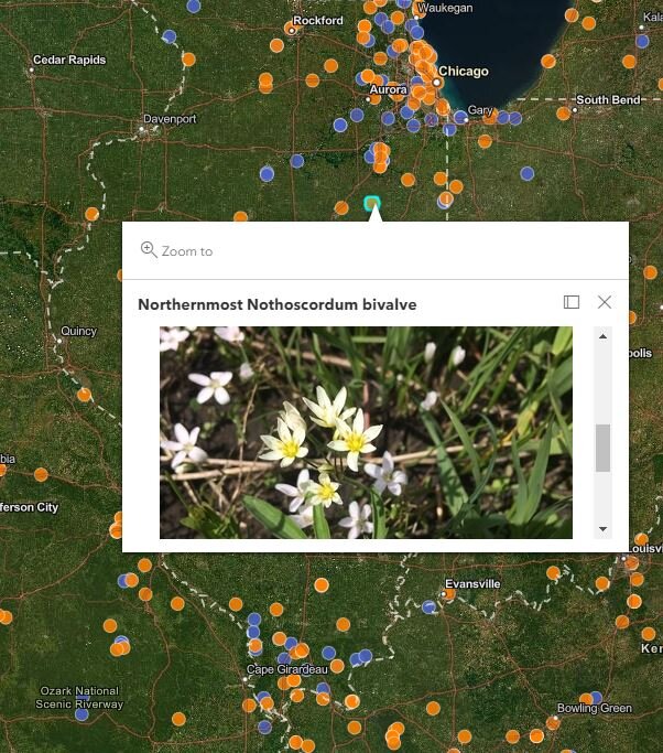
Each orange dot is a different species, and marks the northernmost location its been observed. Each blue dot is the southernmost (most are obscured by the orange). Click through to get to the zoomable map and find records to be broken near where you live.
The edges of (all) life
Although ecologists can study a lot, we cannot study everything. We can’t spend the time to get to know the intricate lifestyles of every species on the planet, or continent. At best we know a few well, but most of our time is spent in classrooms, writing papers, and reading research. So how can us scientists possibly hope to notice if any given species starts dying off from climate warming, or if a species does indeed track its climate northward as the summers heat up?
We can’t.
Only by working with community members and the general public can we even hope track how climate change is impacting life.
With National Geographic, ESRI, and iNaturalist, I’ve started a project to establish the northernmost and southernmost occurrences of all species in North America (plants for now, expanding globally soon). The project uses community sourced data - data that any individual can collect easily and quickly on their phone - with automated code that filters new observations down to those that set new geographical records.
For example, you see a yellow-crownbeard in northern Illinois. You snap a picture with iNaturalist, which records the location and helps identify the species. The Edges of (All) Life project automatically checks to see if you set a new record for the northernmost crownbeard. Let’s imagine you do set that record, the northernmost yellow crownbeard ever formally recorded. That’s pretty darn cool!
On the next update, the record will appear on the map, you’ll be a new record holder, and our knowledge of where the species exists and how its moving will be pushed dramatically forward.
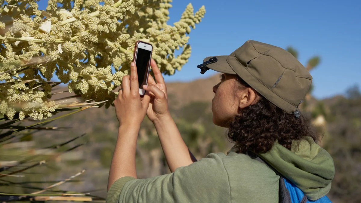
Photo: iNaturalist
Does it take a lot of scientific knowledge? No - iNat is extremely easy to use and helps you identify species you don’t know. Using the image itself it’ll give you suggestions and ideas, and others will verify each record anyway - so don’t worry.
The sampling is quick, less than a minute. You’ll learn something. And you can set global records in your backyard.
Exploration is something we are all born to do, from childhood on. You can still do that, no matter where you live. You can push truly global science forward.
Read more about the project here, which also includes a link to iNaturalist and instructions. The rest is automatic. So go set a record! And please let me know when you do - just send a note - I love to hear the stories.
Link (or click map above): https://storymaps.arcgis.com/stories/29c6ac1c2f4e4f93beabba73a42ac7b1